Mahmud Kamal Anamul Haque
Drainage pattern is the method of water flow from upstream to downstream. The main medium in this case is the river. From the source place a river flows along the slope. This is because of the gravitational pull of the earth. The droplets form a stream of water together. Tributaries come from different directions and increase the amount of water in the stream. In this way, a large stream of water takes the form of a river. Rivers and tributaries get their water supply from the land under drainage basin. A tributary of a river can be seen by looking downwards.
The arrangement of the tributaries of a river is called drainage type or arrangement. Multiple analyzes of the ecosystems of watercourses in drainage basins have shown that aqueduct networks follow a few different types. Different types of drainage systems have been developed in different areas based on the topography of different areas and the nature of different erosion resistant rocks. The shape of the format depends on the changes in the rock layer, soil, climate and river flow of the area concerned. The drainage pattern of an area is considered to be a good indicator of the nature of the underlying rock layer, topography, nature of the terrain etc.
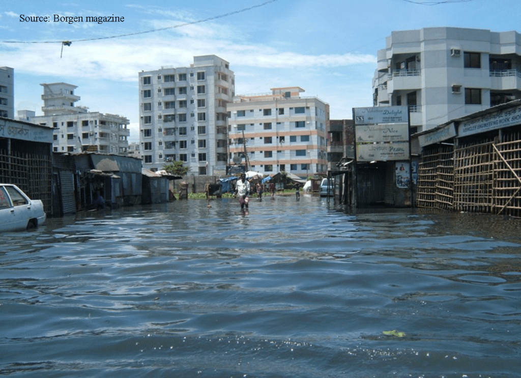
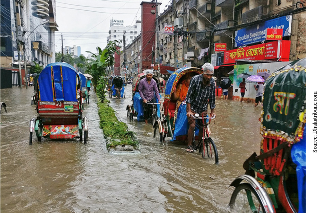
Waterlogging means extreme suffering. This condition is due to the destruction of the normal drainage system. In fact, waterlogging is that the water cannot come out in a confined space. But in the capital of Bangladesh, the water is a little late, but it comes out. Now we have to see why the water logging is happening? There is a misconception in our water management.
The most notable feature of the landscape of Bangladesh is provided by the rivers which have shaped not only its physiography but also the way of life of the people. The rivers of Bangladesh, however, are subject to constant and sometimes rapid change, which may affect the hydrology of a large region; As a result, no description of the topography of Bangladesh has retained its perfect accuracy for a long time. A striking example of this national change was seen in 1878787, when the river Teesta went through exceptional flooding; Its water suddenly moved eastwards, where they strengthened the Brahmaputra. As a result, the swollen Brahmaputra began to flow in a small stream, which became the bottom of the river in the early 1800s, now known as the Jamuna. Many small rivers (Old Brahmaputra) have flowed through the previous path of Brahmaputra.
None of the major rivers of Bangladesh originate in the territory of the country. Surma’s headwaters are in India; The Upper Padma rises in the Jamuna of Nepal and China, but they also reach Bangladesh across Indian territory. Thus, it gives irrigation that Bangladesh lacks complete control over the flow of any stream. The construction of upstream dams at Farakka in West Bengal has resulted in substantial evolution of water from the Ganges in India and insufficient flow in West Bangladesh during the dry season from November to April. Equal distribution of river water has been a source of contention between India and Bangladesh since the 19th century.
The management for our Dhaka in Bangladesh is called cordon approach. At one time it was said that if we culvert the box over the canals around Dhaka, the water would flow through the bottom and the vehicles would pass over it. It was actually the wrong decision. By doing this, we have destroyed the normal drainage system. It is actually somewhat man-made and somewhat necessary Dhaka is an unplanned city. What we have done to give people a chance to live here has gone against nature.
Why is the water being drained first? The main reason is that we do not have a reservoir in
Dhaka city If it rains, we have to hold that water for a while If not, it is coming into the street. The road is sinking. We have nothing to say about ponds and ditches. If we take Dhaka city for 400 kilometers, we will see that there are houses, roads or concrete in the three hundred and fifty kilometers. As a result, water cannot go through those places. This is a big part of the rain, but it was supposed to suck on the ground. That is not happening. Now the way we drain water in Dhaka city is artificial water pumping. That means we are pumping out water.
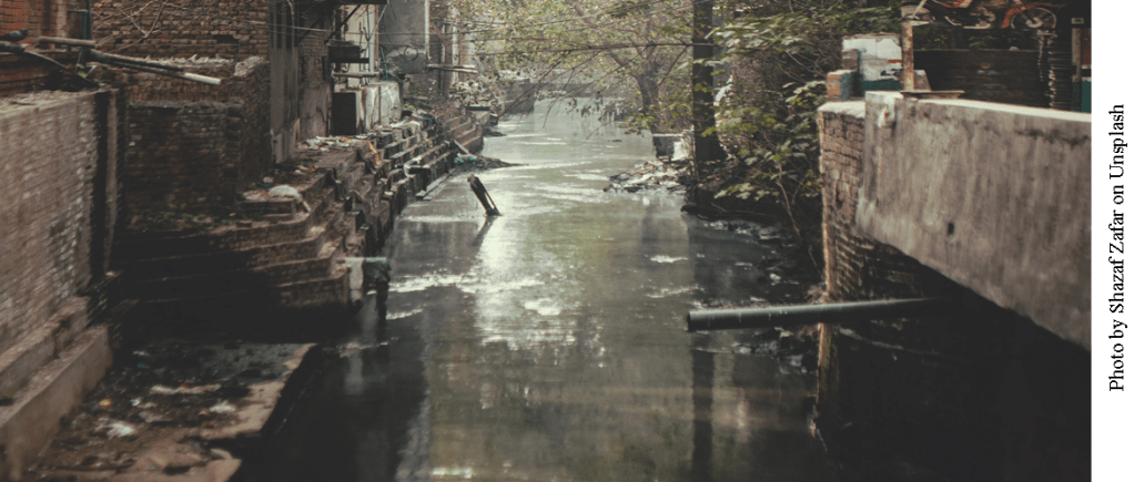
We have destroyed the natural drainage system What I am doing now is Artificial Drainage System. We did not have such problems in 1953, 1974, 1972, 1975. The population we had then has increased a lot now. In Bangladesh, Dhaka city is surrounded by four rivers Turag, Buriganga, Shitalakshya and Balu. Inside there are 65 vein-like. Dhaka’s two city corporations are doing some storm water drainage at the moment. They are paving the way for rain water to go.
Dhaka WASA has three jobs. First, water supply. Secondly, sewerage management and thirdly, water drainage. Between June and October each year, the rivers overflow their banks and submerge in the countryside, rising the most in September or October and flowing faster in November. Waterlogging is both a blessing and a curse. Without these it would not be possible to replenish the fertile silt deposits, but severe floods regularly damaged crops and destroyed settlements and sometimes took a heavy toll on human and animal populations.
A parallel drainage pattern is seen on the same type of rock layer with a relatively steep slope. A different type of drainage arrangement is created when the rock units are arranged or arranged in parallel as weak and strong rock layers. Rivers generally tend to follow lower erosion-resistant rock layers, so that in the lattice-like drainage pattern, the primary tributaries meet at right angles to the main stream, and the secondary tributaries flow parallel to the main stream. Large rivers occupy irresistible rocks. Smaller and smaller rivers, on the other hand, drain the resistant glaciers and geologically higher river basins. Tilted or folded, the sequence of hard and non-solid sedimentary rock layers shows a lattice-like drainage pattern.
Such drainage patterns are also formed in areas with parallel elongated landforms such as glacier-accumulated drumlin landforms or beach cliffs. This type of drainage exists in the southwestern part of the Barind region, which includes the folded Appalachian and the Eastern Ballet and the Bengal plain. The periodic location of sandstones and shales, which are commonly found in the hilly geological formations of the country, helps in the formation of earthen-like drainage patterns.
Drainage system in Bangladesh of Dhaka city is a consequence of unplanned development. Due to rapid urbanization with unplanned construction, most of the stormwater drainage rivers have been drained, filled, removed and obstructed to flow to the flowing rivers, causing severe waterlogging in the city during the monsoons causing huge damage. Adverse social, physical, economic and environmental spending conditions. The need for the government to take corrective action on a priority basis. The city of Dhaka is heading towards an environmental catastrophe due to the gradual destruction of natural sewage and water bodies and neglect in the effective management of the urban hydropower system. Stable drainage systems can form a key part of sustainable development by minimizing the effects of water flow and water sources that may otherwise occur. Close coordination between city authorities and agencies and development of waterlogging situation requires effective management of natural drainage system and cooperation between public and private sectors for sustainable development or restoration and management.
Author is an Executive Editor at
The Environment Review
Email: mahmudkamalk@gmail.com
